A Hydrological Analysis of Urban Growth, Flood Risk, and Environmental Sustainability
Prepared by: Hydro Concepts (U) Ltd.
Sector: Urban Hydrology, Environmental Engineering, Water Systems Planning
Executive Summary
Kampala is a city built on water, yet modern development increasingly ignores the natural systems that have shaped its hills, valleys, and wetlands for millennia.
- Hills generate runoff; valleys channel it; wetlands filter and slow it; Lake Victoria receives it.
- Urbanization has created impervious surfaces that accelerate runoff, overwhelm channels, and carry sediment, pollutants, and debris into wetlands and the lake.
- Many neighborhoods, including Murimira, Bwaise, Lubigi, and Nakivubo, now face recurrent flooding, infrastructure failure, and economic losses.
Key findings:
- Hydraulic Failure: Capillaries clogged, veins narrowed, arteries choked, wetlands failing.
- NDV Loss: Economic gains from hasty development are outweighed by environmental costs and social losses, producing negative-sum outcomes.
- Policy & Governance Gaps: Weak enforcement of wetland buffers, parceling of drainage corridors, and reactive interventions exacerbate flooding.
- Engineering Urgency: Immediate desilting, wetland restoration, rainwater harvesting, and stormwater detention are essential.
Conclusion: Every rainstorm deposits another debit in nature’s ledger. The question is whether Kampala will repair the body that sustains it or continue ignoring the warnings until disaster strikes.
Part I — The Hydrological Story of a City
1. Cities Are Built on Water
Concrete feels permanent. Steel feels permanent. Glass towers feel permanent. Yet beneath every city lies a far older, more powerful system: water.
Rain fell on the hills of what is now Kampala thousands of years before the first road was laid. Water already knew the landscape intimately:
- From the hills, rainwater flowed down gentle slopes.
- Valleys acted as natural drainage corridors.
- Wetlands absorbed excess water, trapped sediment, and filtered pollutants.
- Lake Victoria received clean water downstream.
This hydrological skeleton was like the bones of a body: it determined how the city could move, grow, and survive.
Modern development behaves as if this skeleton does not exist: drainage channels are narrowed, wetlands filled, streams diverted, and natural soils buried beneath asphalt and concrete. At first, consequences seem minor. But nature keeps accounts with extraordinary patience—and eventually presents the bill.
2. The Hydrological Body of Kampala
Urban drainage functions like the circulatory system of a human body:
| Component | Analogy | Function |
| Street drains and gullies | Capillaries | Collect rainwater at source |
| Neighborhood channels | Veins | Transport water downstream |
| Major drainage corridors | Arteries | Move large flows across the city |
| Wetlands | Kidneys / Liver | Store, filter, and purify water |
| Lake Victoria | Heart / Outlet | Receives final flow |
The Raindrop Journey (Stage Analysis):
Stage One – Capillaries:
- Small roadside drains collect runoff from rooftops and paved surfaces.
- Many drains are 60–90% blocked with plastic, debris, and sand.
- Flow spreads onto streets, increasing local flooding.
Stage Two – Veins:
- Neighborhood channels carry water from multiple streets.
- Observations in Murimira show channels 75% filled with silt and debris.
- Hydraulic formula: Q∝AQ (flow depends on cross-sectional area). Reduced A → reduced capacity → overtopping.
Stage Three – Arteries:
- Lubigi, Nakivubo, Nalukolongo channels carry runoff from vast areas.
- Sedimentation, blockages, and neglected culverts reduce flow capacity.
- Peak flows exceed design limits during heavy storms.
Stage Four – Kidneys (Wetlands):
- Lubigi, Nakivubo, Kinawataka wetlands once provided temporary storage, sediment trapping, and purification.
- Encroachment and drainage for construction have reduced their capacity. Wetlands cannot buffer peak flows.
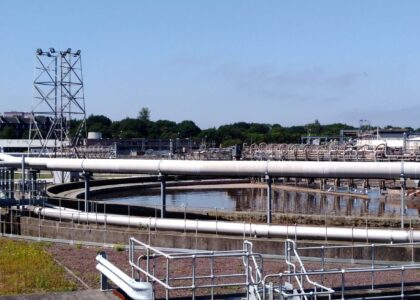
Stage Five – Final Outlet (Lake Victoria):
- Sediment, domestic, and industrial pollutants degrade water quality.
- National Water and Sewerage Corporation extends intake pipes at Gaba to access clean water.
3. Urbanization and Impervious Surfaces
Urbanization converts natural landscapes into surfaces that do not absorb water. Rain becomes runoff, increasing flood risk.
| Surface Type | Runoff Coefficient (C) |
| Forest | 0.10–0.20 |
| Grassland | 0.20–0.35 |
| Residential areas | 0.40–0.60 |
| Commercial districts | 0.70–0.95 |
The more impervious the surface, the faster water moves downhill, compressing the time of concentration (tc) and producing higher peak flows

4. Climate Change and Rainfall Intensification
Research across East Africa indicates that extreme rainfall events are increasing in both intensity and frequency.
- Hills generate higher runoff due to impervious surfaces.
- Channels already silted cannot carry the increased flows.
- Wetlands further encroached cannot absorb excess water.
- Result: floods occur faster and are more destructive.
Each delay in remediation compounds the technical difficulty and cost of restoring the system.
5. Sediment and Pollution Pathways
Urban runoff carries more than water:
- Murimira and Lubigi channels: cross-sections 75% filled with silt, debris, and plastics.
- Industrial effluents and domestic wastewater enter untreated.
- Downstream consequences: overtopped channels, eroded banks, and polluted water entering Lake Victoria.
6. When Two Hours Are Enough — What Happens When the Sky Refuses to Close?
No human being can stand under the rain and command it to stop. Even those who once claimed the mystical ability to summon or disperse clouds—the so-called rainmakers—could rarely control the skies with certainty. Rain follows the laws of atmospheric physics, not municipal decrees.
It is important to remember that, thus far, the flash floods frequently witnessed in Kampala are typically triggered by as little as two hours of intense rainfall. Two hours. That is all it takes for sections of the city to descend into chaos—roads submerged, businesses closed, homes flooded, and drainage channels overwhelmed.
Now pause and stretch the imagination just a little further.
Imagine that same intensity of rainfall falling continuously for an entire day. Not two hours, but twelve, eighteen, or twenty-four hours of relentless downpour.
Imagine the hills of Kampala shedding water without pause.
Imagine every rooftop, every parking lot, every paved road pouring runoff into the already constricted drainage channels.
Imagine wetlands already compromised by encroachment being asked to absorb a deluge far beyond their remaining capacity.
The consequences would be catastrophic.
Channels already narrowed by construction would become torrents. Culverts would choke with debris. Low-lying neighbourhoods would disappear beneath brown floodwater. Roads would turn into rivers, and the city’s mobility—its economic bloodstream—would stall.
This scenario is not an exercise in exaggerated alarmism. It is a documented reality elsewhere on the planet. Cities far wealthier, far more technologically equipped, and far better engineered than Kampala have been humbled by extreme rainfall events.
From the inundation of **New York City during the remnants of Hurricane Ida, to catastrophic flooding in **Houston during Hurricane Harvey, even advanced metropolitan regions have discovered that water obeys hydrology, not urban pride.
If such cities—with their massive stormwater tunnels, reservoirs, and sophisticated flood modelling—can still be overwhelmed by sustained rainfall, then Kampala’s fragile drainage network must be examined with sober realism.
Street sweeping campaigns and cosmetic cleaning exercises cannot substitute for hydrological understanding. Washing city streets with water while drainage channels remain silted and wetlands are suffocated by encroachment is akin to polishing the surface of a ship while ignoring the holes forming in its hull.
Water does not negotiate with appearances.
It follows gravity, volume, and time.
And when rainfall persists long enough, every weakness in the landscape becomes a pathway for disaster.
It is therefore deeply troubling that the prevailing response to Kampala’s drainage crisis often appears to be theatrical rather than hydrological.
7. A Divine Warning Ignored?
What if, all along, all this time, the Almighty God has been sounding an alarm—a warning in every flood, every overflowing channel, every silted wetland—and each time, it has been ignored?
No serious hydrological interventions have ever been commissioned to address Kampala’s drainage challenges in a sustained, systemic way. The warnings came as visible consequences of neglect, yet the city continued to expand with little respect for the natural system that carries its water.
And now, perhaps, He has chosen this very article, this meticulous assessment of hydrology, urbanization, and flood risk, as a further clarion call. Every page, every chart, every analysis is a message: heed the natural laws of water before calamity strikes.
Flooding is not just a technical failure—it may also be a moral one, a warning encoded in the behavior of nature itself. Ignoring it risks not only infrastructure and livelihoods but the very stability of the city’s life and prosperity.
8. Lake Victoria, the Nile, and the Hidden Consequences of Diminished Infiltration
In the past, rainfall across the Kampala metropolitan area rarely caused immediate havoc because the land itself absorbed a significant portion of the water. Rainwater percolated and infiltrated the soil, traveling slowly through subsurface flow toward Lake Victoria. By the time this water reached the lake, runoff had been naturally regulated, and any excess was gradually carried away by the Nile River, maintaining equilibrium in the broader watershed.
Today, the situation has changed drastically. With increasing urbanization, impervious surfaces dominate: rooftops, asphalt, concrete, and compacted soils leave little room for infiltration. Subsurface flow has diminished sharply, and the lake now receives vast volumes of water rapidly with every rainfall.
This accelerated inflow is not a hydrological triumph. On the contrary, it is a warning. Lake Victoria rises faster than ever before, and the regulated outflow through the Nile—once safely managed by its cascade of hydroelectric dams—is increasingly stressed. During prolonged or extreme rainfall events, these flows can exceed the design limits of the dams, threatening structural safety and triggering uncontrolled downstream flooding.
The cascading consequences are profound:
- Infrastructure at risk: Hydropower dams, embankments, and urban drainage downstream can be overwhelmed.
- Economic losses: Flooded communities, destroyed crops, disrupted transport, and industrial shutdowns.
- Social impact: Loss of life, displacement, and heightened disease risk.
- Environmental degradation: Accelerated shoreline erosion, wetland stress, and water quality deterioration.
Kampala’s failure to allow rainwater to infiltrate is therefore not merely a local drainage issue—it is a regional hazard. Every rooftop, every paved lot, and every narrowed channel upstream contributes to a faster, higher, and more dangerous surge into Lake Victoria and the Nile.
9. The Illusion of Street Cleaning
Recent city initiatives to wash streets in the central business district are theatrical.
- Debris is swept into drains that are already blocked downstream.
- This is a clownish affair, demonstrating a management entity that does not understand water dynamics.
- It transfers risk rather than solving it.
Cleaning the CBD while ignoring downstream channels is like brushing your teeth and swallowing the debris. The problem moves, but does not vanish.
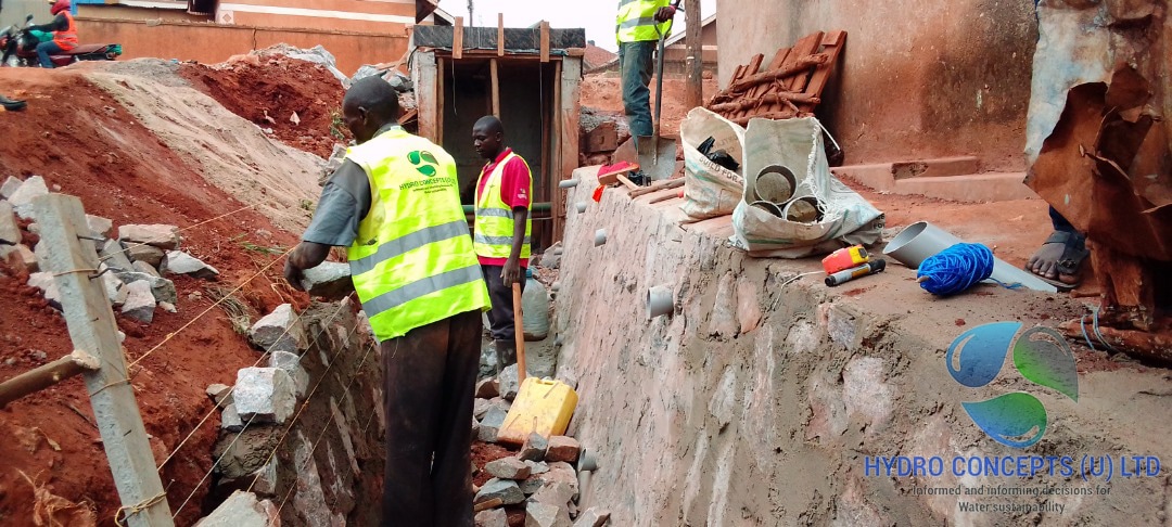
10. Building on Drainage Channels
Construction atop drainage corridors, particularly Nakivubo Channel, creates multiple compounded risks:
- Hydraulic reality: Water always finds the path of least resistance. Structural joints, plumbing penetrations, foundation cracks become conduits.
- Spatial narrowing: Reduces the geographical scope available for corrective engineering. Future remediation becomes costlier and technically complex.
- Flood amplification: Buildings transform previously manageable flow paths into destructive hazards.
Building over drainage corridors is not merely unwise—it is an act that locks the city into future disasters.
Hydrologically, this is a call to action: restore infiltration, protect wetlands, and re-engineer drainage pathways—not only for the city’s sake, but for the stability of the lake and river system that millions rely upon downstream.
Part III — Human and Economic Dimensions
11. The Social Face of Flooding
Flooding is not just a hydraulic problem—it is a human tragedy. Neighborhoods like Murimira, Bwaise, Namungoona, etc., experience recurrent floods, where each storm disrupts lives and livelihoods.
- Murimira Zone: 5,000–10,000 residents affected during moderate storms.
- Homes are inundated, electrical systems damaged, and streets become impassable rivers.
- Loss of income occurs as businesses close temporarily, sometimes permanently.
- Health risks increase due to waterborne diseases from polluted runoff.
A single storm can displace families overnight, destroy small businesses, and create cascading social costs that last weeks. These consequences are seldom captured in economic statistics but form a significant component of the Net Development Value (NDV).
12. Net Development Value (NDV) Applied
The NDV framework evaluates development by balancing economic gains (EG), environmental costs (EC), and social losses (SL):

Case Study – Murimira Neighborhood
| Scenario | EG ($M) | EC ($M) | SL ($M) | NDV ($M) | Interpretation |
| Business-as-Usual | 0.5–1 | 1–3 | 0.5–2 | –3 to –8 | Negative-sum; minor gains offset by losses |
| Environment-Prioritized | 2–5 | 0.5–1 | 0.2–0.5 | +1 to +4 | Positive-sum; sustainable benefits |
| Rushed / Politically Driven | 1–3 | 2–5 | 1–4 | –2 to +0.5 | Near zero-sum; short-term gains erased by long-term costs |
Key Insight: Hasty or ill-planned development inevitably erodes economic gains, leaving communities in cycles of recurrent disasters.
13. Climate Change and Intensifying Rainfall
- Extreme rainfall events in Kampala are becoming more frequent and severe.
- Increased impervious surfaces amplify peak runoff, reducing the time for water to travel to channels (tc), producing higher Q (flow rate).
- Silted channels and encroached wetlands exacerbate flooding.
- Delays in intervention make rehabilitation exponentially more difficult and expensive.
Part IV — Solutions and Recommendations
14. Wetlands and Stormwater Detention
Wetlands are natural flood buffers, but artificial measures can complement them:
Functions of Wetlands:
- Temporary storage of excess runoff
- Sediment trapping
- Water purification
- Groundwater recharge
Stormwater Solutions:
- Detention basins: Store upstream floodwater temporarily, reducing downstream peaks.
- Rainwater harvesting: Roof-based systems capture rainfall for later use.
Principle: Reducing peak flow decreases the likelihood of channel overflow, but these measures cannot compensate for blocked channels or buildings atop flow paths. Wetlands must be protected and restored at scale.
15. Green Infrastructure and Urban Planning
Urban design can help replicate natural hydrology:
- Permeable pavements: Allow infiltration, reducing runoff.
- Vegetated swales and green roofs: Slow water movement, filter pollutants.
- Retention ponds and micro-basins: Temporarily store stormwater in residential areas.
These strategies reduce flood peaks, enhance groundwater recharge, and improve urban water quality.
16. Policy and Governance Failures
Kampala’s drainage crisis is not purely technical—it is political and structural:
- Parceling atop drainage channels: Reduces space for re-engineering and heightens risk.
- Weak enforcement of wetland buffers and riparian zones: Encourages encroachment.
- Limited maintenance budgets: Leads to silted, ineffective channels.
- Reactive interventions: Cleaning streets in the CBD while ignoring downstream channels demonstrates a lack of hydraulic understanding—a “clownish affair” that moves debris without solving the problem.
Consequences: Encroachment and mismanagement amplify flood risk, reduce NDV, and increase social costs. Integrated, proactive governance is essential.
17. Engineering Interventions and Recommendations
A comprehensive approach is required to repair Kampala’s drainage body:
- Systematic desilting of major and secondary channels – Immediate relief for clogged arteries.
- Strict enforcement of no-build zones along channels – Restores room for flow and prevents future blockages.
- Wetland restoration and protection – Lubigi, Nakivubo, Kinawataka.
- Stormwater detention basins upstream – Reduces downstream flood peaks.
- Rainwater harvesting infrastructure – Roof-level and community-scale collection.
- Green infrastructure – Permeable pavements, vegetated swales, and green roofs.
- Monitoring and early warning systems – Flash flood alerts and community preparedness.
- Public engagement and environmental education – Communities become part of the solution.
Engineering Principle: Work with nature, not against it. Blocking natural pathways or treating water infrastructure as optional will always produce long-term disaster.
Part V — The Bill That Nature Presents
18. Cumulative Stress on Kampala’s Drainage Body
- Capillaries (street drains) clogged → local flooding.
- Veins (neighborhood channels) narrowed → overwhelmed during storms.
- Arteries (major channels) silted → peak flows exceed design limits.
- Kidneys (wetlands) failing → insufficient storage and filtration.
- Final outlet (Lake Victoria) polluted → water treatment costs rise.
Each rainfall deposits another debit in nature’s ledger.
19. Roadmap for Remediation
Short-term:
- Desilting and cleaning clogged channels.
- Protect wetlands from further encroachment.
Medium-term:
- Construct upstream detention basins and rainwater harvesting systems.
- Implement green infrastructure in residential and commercial districts.
Long-term:
- Strict zoning and enforcement of no-build corridors.
- Comprehensive stormwater management planning integrated into urban development.
- Ongoing monitoring, maintenance, and community engagement.
Economic & Social Justification: Positive NDV occurs when interventions are implemented promptly, reducing environmental and social costs and enabling sustainable development.
Conclusion: A Crossroads for Kampala
Kampala stands at a pivotal moment. The rains will continue to fall. The hills will generate runoff. Water will follow its natural course toward Lake Victoria and beyond, tracing the pathways that nature designed long before the first road or building appeared.
The question is no longer hypothetical: will the city repair the body that carries this water, or continue to ignore it until catastrophe strikes?
The evidence is clear. Channels are silted, wetlands are encroached upon, drainage corridors are blocked by construction, and infiltration has diminished to a fraction of its former capacity. Every storm deposits another debit in nature’s ledger—a debit that compounds with time, threatening homes, livelihoods, infrastructure, and even the stability of Lake Victoria and the Nile downstream.
Hydro Concepts (U) Ltd. therefore urges immediate, decisive, and systemic action:
- Desilt and rehabilitate all major and secondary drainage channels, and institutionalize routine maintenance.
- Restore and protect wetlands as natural flood buffers and filtration systems.
- Strictly enforce building regulations and no-build zones along all primary and secondary drainage corridors.
- Integrate stormwater management throughout urban planning, including detention basins, rainwater harvesting, and green infrastructure.
- Educate and engage the public, ensuring communities understand the risks and become active partners in managing water responsibly.
Delay is costly. Every year of inaction compounds the technical, economic, social, and environmental debt, making remediation progressively more difficult, expensive, and potentially disastrous.
Hydro Concepts (U) Ltd. stands ready to lend expertise and hands-on support, but the city must first acknowledge the gravity of the challenge and act without hesitation.
Kampala can still choose a path of resilience, foresight, and sustainability—but that choice must be made before the next storm reminds us all of the consequences of neglect. Nature is patient, but it never forgets, and it certainly does not wait.
1. Tables Included
- Runoff Coefficient Table
| Surface Type | Runoff Coefficient (C) | Impact on Flooding |
| Forest | 0.10–0.20 | Low runoff, high infiltration |
| Grassland | 0.20–0.35 | Moderate runoff |
| Residential | 0.40–0.60 | Significant runoff, risk of street flooding |
| Commercial | 0.70–0.95 | Almost all rainfall becomes immediate runoff |
- NDV Scenarios Table
| Scenario | EG ($M) | EC ($M) | SL ($M) | NDV ($M) | Interpretation |
| Business-as-Usual | 0.5–1 | 1–3 | 0.5–2 | –3 to –8 | Negative-sum; short-term gains erased |
| Environment-Prioritized | 2–5 | 0.5–1 | 0.2–0.5 | +1 to +4 | Positive-sum; sustainable development |
| Rushed Development | 1–3 | 2–5 | 1–4 | –2 to +0.5 | Near zero-sum; temporary gains offset by losses |
- Channel Sedimentation and Pollution Table
| Channel | Sediment Fill (%) Estimated | Plastic / Debris | Industrial Waste | Impact |
| Murimira | 75% | High | Moderate | Neighborhood flooding |
| Lubigi | 60–70% | High | High | Peak flow overwhelm, erosion downstream |
| Nakivubo | 50% | High | High | Major flooding, infrastructure damage |
This article has been meticulously developed and published by the Hydro Concepts (U) Ltd. team, drawing on our expertise in urban hydrology, environmental engineering, and water systems planning to provide actionable insights for the sustainable management of Kampala’s water resources.